Project Overview
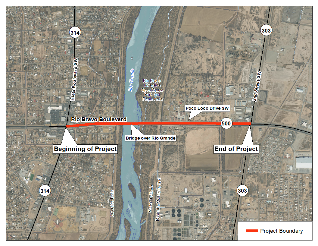
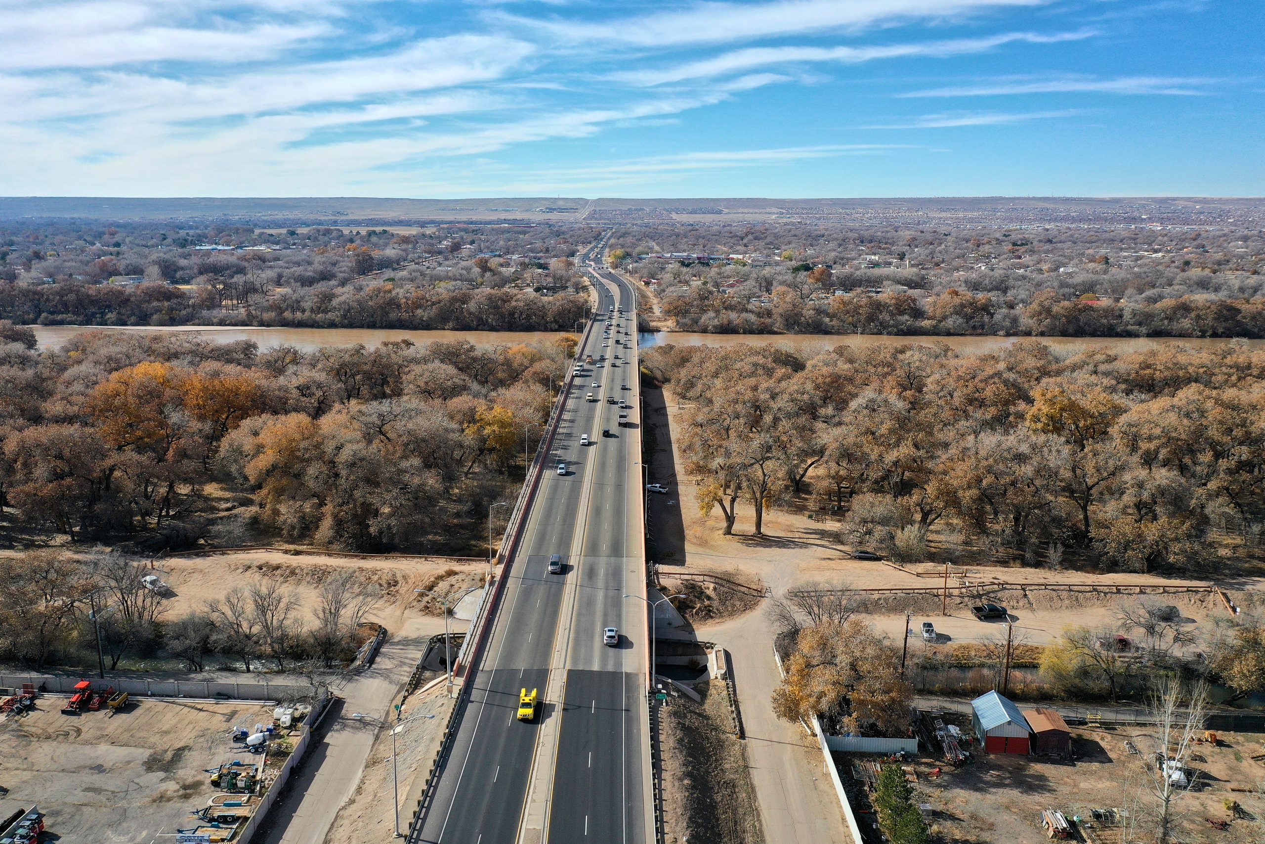
The New Mexico Department of Transportation (NMDOT) in cooperation with the Federal Highway Administration (FHWA), is preparing to replace the east- and west-bound bridges on NM Highway 500 (Rio Bravo Boulevard) spanning the Rio Grande in Albuquerque within Bernalillo County. The Project Area is located on NM 500 between NM Highway 314 (Isleta Boulevard SW) and NM Highway 303 (2nd Street SW), and includes the two bridges crossing the Rio Grande and two bridges crossing the Middle Rio Grande Conservancy District (MRGCD) Albuquerque Riverside Drain. Rio Bravo Boulevard is a critical east-west route in Albuquerque’s South Valley and is one of seven Rio Grande crossings in the Albuquerque metro area.
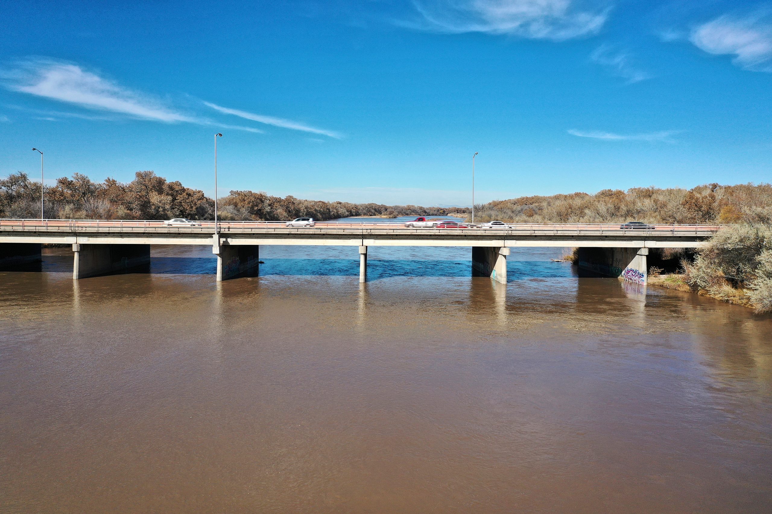
The purpose and need for this project is to address structural deficiencies while also reducing congestion and improving multi-modal transportation system connectivity within the project limits. The needs are based on the fact that the eastbound river bridge is in poor condition and requires replacement, pedestrian and bicycle facilities are discontinuous in the project limits, and it has been determined that additional river crossing capacity is needed in the metro area.
MAINTENANCE IS UNDERWAY!
Starting the week of March 6, work will begin on the NM 500 (Rio Bravo Blvd.) Bridge. This critical maintenance will include joint work and patching the bridge deck to provide a safer, smoother ride for travelers using the Rio Bravo Bridge.
TRAFFIC IMPACTS:
Daily one-lane closures will occur, in the eastbound direction only, from 9:30 AM to 7:00 PM. All travel lanes will be open during the morning rush hour. Maintenance work is underway now and will be ongoing through June 2023.
FOR MORE INFORMATION
Please contact Kimberly Gallegos at:
Email: Kimberly.Gallegos@dot.nm.gov
Phone: 505-639-3576
For Americans with Disabilities Act (ADA) or Civil Rights Title VI accommodations and/or more information call Kimberly Gallegos.
Por favor comuníquese al 505-418-4900 si desea esta informacion en Español.
Public Involvement
Public and Agency Coordination
The Phase IA/B study phase was performed in 2020-2021 and included agency and stakeholder coordination to identify needs and key issues so they could be addressed in the collaborative development of the proposed improvements. The Federal Highway Administration (FHWA) is the lead agency for National Environmental Policy Act (NEPA) compliance, with NMDOT as the project proponent acting on behalf of FHWA. Coordination was undertaken with other federal, state, and local agencies with jurisdiction and/or responsibility for lands and resources within the project area as well as
members of the local community.
The study team hosted a public involvement meeting on Wednesday, December 9, 2020. The structure and content of the public meeting were a virtual meeting platform scaled to the context of the local community and the project’s purpose and need. In addition, the project team conducted interviews with eight property owners in June 2021 to discuss the project with those adjacent to the Rio Bravo Boulevard corridor. Common concerns centered around noise from traffic and trucks along the corridor, impacts from construction traffic through local neighborhoods, drainage and flooding concerns, Dean Road and Rio Bravo Blvd intersection safety, impacts to properties, the safety of the nearby properties and crime, pedestrian and bicycle access, and continued notifications of public meetings and project updates to the local property owners.
Input was gathered to identify issues of interest and concern and to develop, evaluate, and refine project alternatives. A preferred alternative was then identified and the Phase A/B Study was completed in September 2021. The Study and project-related information can be found in the PROJECT RESOURCES below.
Thank you for your participation!
A public meeting was hosted in April 2022 to provide a summary of the previous study phase public meeting and feedback, identify the recommended alternatives and proposed improvements, present the maintenance of traffic and adjacent projects, and outline the project development process and schedule.
Phase A/B Public Comment Summary Report
July 2022
Recording of Virtual Public Meeting
April 2022
Phase A/B Study Final - CN A301000
September 2021
Phase A/B Public Comment Summary Report
March 2021
Phase A/B Virtual Public Meeting
December 2020 (Recorded Event)
Project Resources
What is Planned for this Project?
Final Design is currently ongoing for a modified version of the preferred alternative from the Study Report prepared for the project. The project will involve the replacement of the Rio Grande Bridges with a 13-span, steel girder bridge with 60” simple-span steel plate girders. The Atrisco Riverside Drain culvert will be left in place and extended to the north. The concrete box culvert adjacent to the Atrisco Drain, which carries an access road, will be removed for the final configuration of the project. A 2-span, pre-stressed concrete slab girder bridge will replace the bridges over the Albuquerque Riverside Drain. The open portion of the drain will be maintained and repaired or replaced, a culvert pipe will cross under a relocated Poco Loco Drive, and the existing culvert pipe under Dean Road will be maintained. In addition to this, retaining walls and pedestrian access elements are under development.
The improvements will include the following elements:
Number and Continuity of Bridges
One bridge crossing the Rio Grande and one bridge crossing the Albuquerque Drain is the recommended alternative, instead of building one continuous bridge, or separating directions of traffic on parallel bridges.
Albuquerque Riverside Drain and Bridges
Replacing the bridges with a two-span, prestressed concrete slab girder bridge and replacing the open portion of the drain with a continuous culvert pipe that crosses under Poco Loco Drive, the Rio Bravo Bridge, and Dean Road, is the recommended alternative.
Rio Grande Bridge Replacement
A 14-span bridge with 60” simple-span steel plate girders was chosen as the recommended alternative.
Atrisco Riverside Drain and West Abutment Location
The recommended alternative includes locating the west abutment behind the west levee, placing the first pier in line with the levee, leaving the Atrisco Riverside Drain culvert in place and extending it to the north, demolishing the existing CBC, and aligning the access road under the first bridge span.
3D PHOTO SIMULATIONS
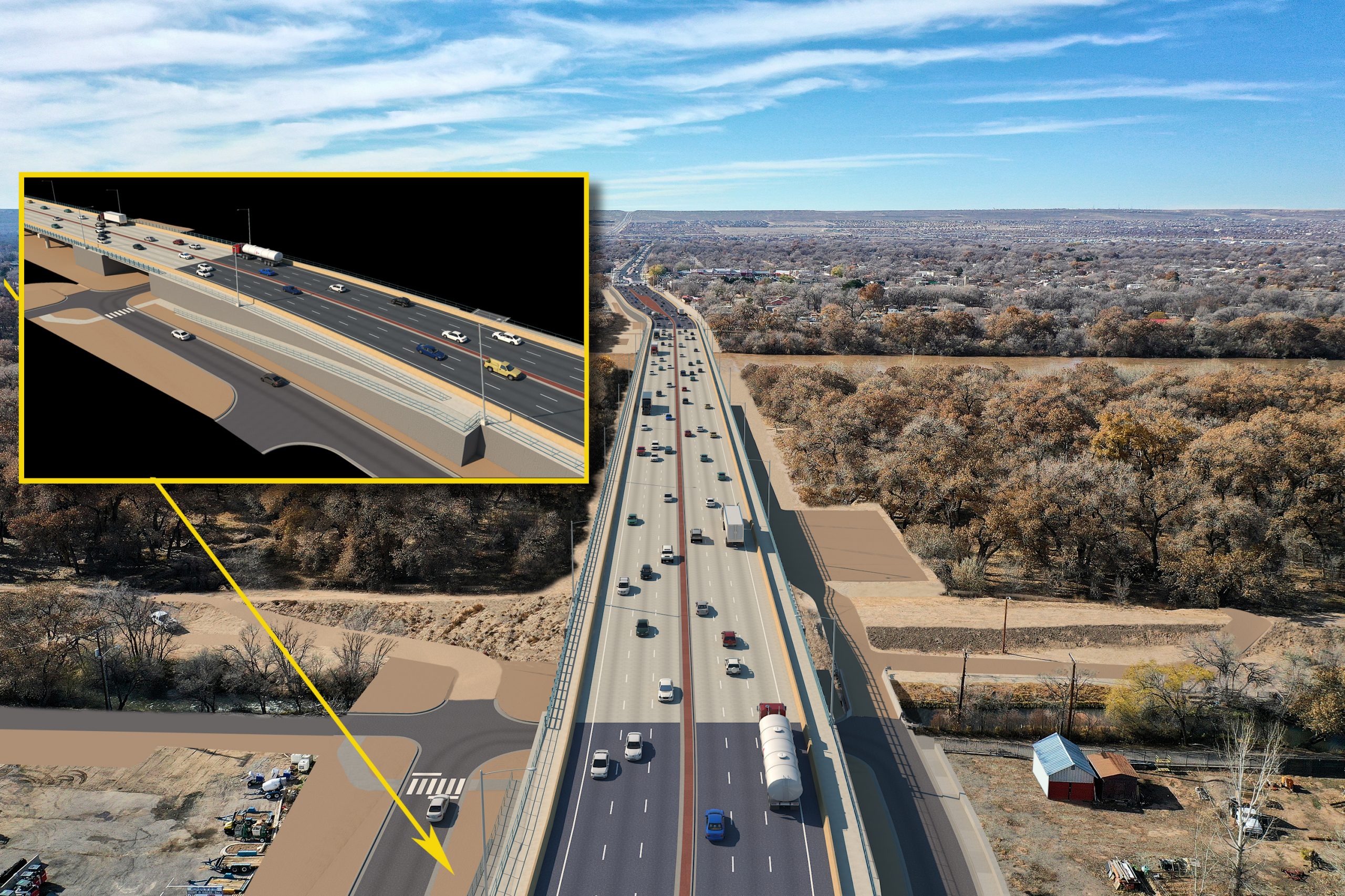
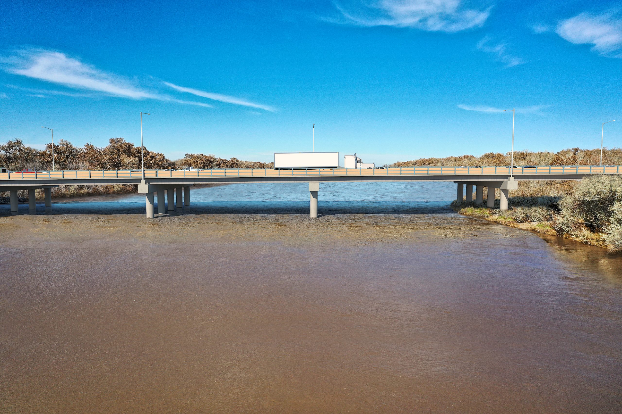
Below are 3-dimensional (3D) photo simulations prepared to illustrate how the proposed bridge improvements would fit within the Rio Bravo Boulevard corridor. These simulations highlight the preferred design alternative (Alternative 6), which is a straight partially offset alignment to the north of the existing alignment. This alternative has an increased profile and longer bridge spans. This preferred design alternative would include pedestrian safety improvements, address key deficiencies to the existing bridge structures, and would be designed with the capacity to add an additional lane of traffic in each direction at an undetermined date in the future.
NM 500 (Rio Bravo Blvd.) Bridge Replacement Project
Project Timeline
SPring 2020
Phase 1A-B Study (CN A301000)
December 2020
Virtual Public Meeting – Study Phase
OcTober 2021
Phase 1A-B Study Completed & FHWA Concurrence Received
Fall 2021 - current
Design Development & Environmental Analysis
April 2022
Virtual Public Meeting – Design Phase
Fall 2024
Finalize Design Plans
Spring 2025
Anticipated Start of Construction (CN A301001)

